Great Circles are any circumference of the earth. The equator for instance is a Great Circle but no other line of latitude is; all lines of longitude are Great Circles. It is possible to draw a Great Circle line between any two points on the earth's surface and that will be the shortest distance between the two points. However this 'Great Circle route' is not necessarily the 'best' route. Here is an illustration of why:
For your Sunday walk this week you decide on a hike across the Sussex Downs, from Duckinfield to Cuckoosmere, a roughly east to west stroll of some twenty miles. There are no obvious paths and you can walk anywhere but, since you have a train home to catch at Cuckoosmere, you decide on a direct route, following a compass bearing taken from your OS map.
You are accompanied by your twin-brother (note 1) who walks at exactly the same pace as you do. By an odd working of a local space-time wormhole, this twin brother of yours happens to have been born c 1000 BC and to be a native of, or at any rate familiar with, the South Downs of Sussex. Despite the gulf in your interests he agrees that a Duckinfield to Cuckoosmere walk would be agreeable so the two of you set off companiably enough.
After a few miles though conversation gets a little strained because you have become separated by several yards. When you ask your brother why he points to something vague on the horizon, “The route to Cuckoosmere.” Not so, you say, the map clearly shows that the route is this way. Your twin shrugs and since you share an obstinacy gene, your respective journeys continue to diverge.
Irritatingly, your twin seems to be ever-so-slightly forging ahead of you and, infuriatingly, he actually arrives at Cuckoosmere a little ahead of you. After dispatching the little tick back down the wormhole you trace out his route on your map. Your own route is a straight line, his is slightly bowed and follows a path slightly to the north of yours.
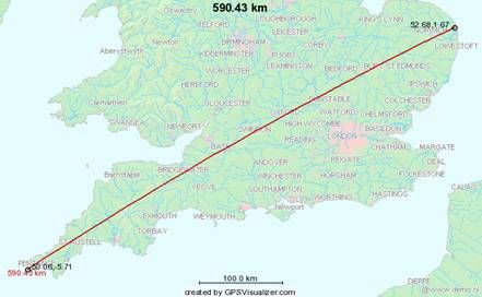
[Diagram of the two Duckinfield to Cusckoosmere routes.]
It turns out that his was the Great Circle route, the shortest route between any two points on the earth’s surface, whereas yours was a compass bearing which (unless it is exactly north-south) never is the shortest route. It looks straight on the map but this is because a map is a two-dimensional rendering of a three-dimensional object. On a globe it would be your twin's journey that is the direct line.
But how did your primitive twin know about Great Circles, familiarity with which would appear to imply a somewhat sophisticated grasp of Global geometry? The answer of course is that he had no such knowledge, he was merely following the line-of-sight route between Duckinfield and Cuckoosmere. Or rather he was following the line-of-sight markers that marked out the line-of-sight route. This is as automatically a Great Circle route as your compass bearing and map route isn’t.
But why is this important for our purposes? If we summon up the wormhole again and get an archaeologist a thousand year into the future to have a look at cropmarks (or whatever they do a thousand years hence) in order to tell us about routes between Duckinfield and Cuckoosmere, he will likely tell us:
The crop marks indicate there are two routes.
1. This one is clearly following the ‘map’n’compass route’ and is therefore relatively modern ie after maps and compasses c 1000 AD. There is no road so the route is presumably recreational ie after c 1900 AD. There will be no other evidence in the landscape though there might be historical evidence.
2. This is the Great Circle route and therefore relatively ancient following line-of-sight markings in the countryside. These markers, or the evidence for same, ought still to be there. It is highly unlikely there will be any historical evidence.
(1) Given the overwhelming gender of British recreational walkers more likely ‘twin-sister’ but we will stick with convention.