New Views over Megalithia

Current topics

Re: New Views over Megalithia

Postby Boreades » 10:24 pm

hvered wrote:
macausland wrote:http://ads.ahds.ac.uk/catalogue/adsdata/arch-352-1/dissemination/pdf/vol_128/128_425_440.pdf

I don't know if it adds anything to the discussion here but it's quite interesting.

It's very interesting! The north-south 'Belinus Line', beginning (or ending) at Plymouth Sound, looks like it crosses Worm's Head, at the Gower Peninsula, and the Menai Strait separating Anglesey from north Wales. But it isn't easy to make out all the details.

I've noticed on some of the old mediaeval maps and before that the British Isles always seem to be an odd shape and at an odd angle. This seems to be because the central point seems to be based in Egypt and looking north west Britain is seen almost in perspective. It's as if it is following the curvature of the earth. Perhaps there was a problem with reconciling a flat surface with the spherical nature of the landscape?

That's plausible, working outwards from the centre.


Yes, it's more than plausible. If you remember your 'O' level Geography, working out from the centre is a spherical or planar projection. Which accurately records the shape of lands from that perspective. But if you cut-out those shapes and put them on a Mercator-style map (a cylindrical projection), it all looks very very strange. Places near the equator get rotated by 90 degrees and squashed or elongated.

IIRC, Hapgood reckoned that was the reason many ancient maps looked so weird, because they were a patchwork quilt of bits cut & pasted from a spherical projection to a cylindrical projection. Also that Alexandria was the centre of the ancient spherical mapping.

This National Atlas page shows how many types of maps there are. Each has its benefits and drawbacks. The issue for us (I think) is figuring out what kind of mapping makes sense in megalithic terms where a "straight line" is also a Great Circle route.
Boreades
 
Posts: 2085
Joined: 2:35 pm

Re: New Views over Megalithia

Postby macausland » 8:47 am

It looks like the academic experts are getting in on the act regarding hillforts.

They're asking for a 'volunteer army' to map every 'hill fort' in Britain and Ireland.

'Prof Lock, who has studied and excavated a number of the forts in England, said that despite their name archaeological evidence suggests they were not primarily used for military purposes.'

He must have been browsing the Megalithic Empire site for ideas.

http://www.bbc.co.uk/news/education-23203500

Apparently the experts believe now that they 'may have been meeting places for religious festivals or market days.'
macausland
 
Posts: 339
Joined: 3:17 pm

Re: New Views over Megalithia

Postby Boreades » 11:19 pm

macausland wrote:It looks like the academic experts are getting in on the act regarding hillforts.
Apparently the experts believe now that they 'may have been meeting places for religious festivals or market days.'


Ha ha!
You've got to keep your eyes open for these coat-turning plagarists.
To do my little bit, I'm inventing my own experts.
Here's one I made earlier.
And another.
Boreades
 
Posts: 2085
Joined: 2:35 pm

Re: New Views over Megalithia

Postby hvered » 5:33 pm

On the matter of hillforts and Plymouth, the site overlooking Plymouth Sound is a peninsula called Rame Head (Ram's Head?).

Image

The chapel on the summit is dedicated to St Michael, making an easily recognisable landmark from sea as well as land.

Cawsand Bay is on the eastern side of the peninsula. Cawsand's village pub is called The Cross Keys Inn, facing St Andrew's Church across the square.. or was (it's now a restaurant).
hvered
 
Posts: 855
Joined: 10:22 pm

Re: New Views over Megalithia

Postby macausland » 7:53 pm

Apparently the Cornish for this place is Dinhir.

This gets translated as long fort which would tie in well with normal theories although some say there is no evidence of such a structure having been built there.

Bronze age items have been found although I don't think that there has been any serious archaelogical digs on the site.

It has been used as a site for beacons in the past. There is also evidence of a rampart of sorts having been built at some point. Perhaps to contain livestock?

http://www.howlsedhes.co.uk/cgi-bin/diskwe.pl

This site gives the following for 'din' and 'hir'. Fort and long which ties in with the standard interpretation.

However it gives an alternative for 'din' as 'tin', because of mutation or lenition in these languages. 'Tin' means 'arse, posterior, and rump.'

Perhaps its real name is something like 'Longbottom' or such like. Perhaps named by a tribe of ancient Lancashire holiday makers?
macausland
 
Posts: 339
Joined: 3:17 pm

Re: New Views over Megalithia

Postby macausland » 9:15 am

http://upload.wikimedia.org/wikipedia/c ... ping_4.jpg

http://www.yorkshiremoors.co.uk/pics/pi ... cliffs.jpg

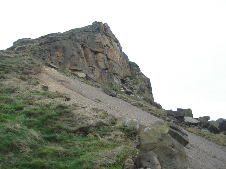
I mentioned in another post about an American archaeologist who reckoned that Roseberry Topping was an artificial pyramid.

Here are a couple of links to photos of the cliff face at the top. It collapsed some time ago and one of the photographs shows some of the blocks as they have come to a rest on the side of the hill.

I don't know how to put the photos on this site so the links will have to do if anyone is interested.

Most of the blocks seem quite irregular to my eye to be formed by some kind of sedimentary process. Any thoughts?
macausland
 
Posts: 339
Joined: 3:17 pm

Re: New Views over Megalithia

Postby hvered » 7:46 pm

The edge of the cliff face looks planed, like a well-designed wall made up of almost identically sized blocks as per the photo you found (the first one is more detailed but rather massive).

Image

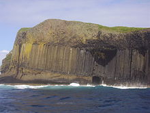
Hard to tell sometimes whether formations are natural. What could look more unnatural than the basalt cliffs of Staffa Island?

Image
hvered
 
Posts: 855
Joined: 10:22 pm

Re: New Views over Megalithia

Postby macausland » 9:55 pm

That's quite true about Staffa and places like the Devil's Causeway but they are quite geometric and regular.

With Roseberry Topping, and I'm playing 'devil's advocate' here, it is the little irregularities that catch my attention.

On the right of the photo there appears to be a 'buttress' leaning against the central structure. If I were to build a pyramid one way of doing it would be to build a central column and then buttresses all the way round giving it support and shape. If it is a buttress it seems to have a separate 'keystone' above it to 'cement it into position.

The hill was originally a regular shape but collapsed some time ago leaving the internal structure on this face exposed. I'll have a look for some old photographs of it taken before the collapse.

The stones seem to be very large in the central body but at the edges are smaller and lean inwards. I would have thought that if it were natural all stones would be vertical but allowing for erosion at the edges. They would still appear vertical though. There are many vertical lines that break up the horizontal feature of it and in some places where rocks have fallen away they seem to have left regular cube like hollows.
macausland
 
Posts: 339
Joined: 3:17 pm

Re: New Views over Megalithia

Postby macausland » 10:15 pm

http://i1.gazettelive.co.uk/incoming/ar ... 269805.jpg

http://www.themodernantiquarian.com/img ... /44298.jpg

http://2.bp.blogspot.com/-3sX_6T9t7uo/U ... ll+-+1.jpg

I can't find the Victorian photo I was looking for but here are three views of Roseberry. The third one is an engraving from about 1846. I don't know how accurate it is or how fanciful but there is another engraving by another artist a bit earlier than this one which is pretty similar.
macausland
 
Posts: 339
Joined: 3:17 pm

Re: New Views over Megalithia

Postby hvered » 1:09 pm

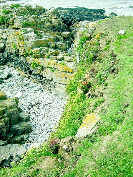
There are two islands at the entrance to the Bristol Channel that are called Flat Holm and Steep Holm, supposedly the petrified head and shoulders of a giant who landed here after another of those slinging matches.

After your comments on Roseberry Topping I'm seeing Flat Holm with a different focus

Image

The stones are rough but look like quarried blocks. The island lies off the most southerly point of Wales called Breaksea Point. Breakwater?

Image

The sea wall was built to protect Aberthaw power station (the Bristol Channel has the second highest tidal range in the world)
hvered
 
Posts: 855
Joined: 10:22 pm

PreviousNext

Return to Index

Who is online

Users browsing this forum: No registered users and 206 guests