WINTERBOURNE ABBAS Walk One
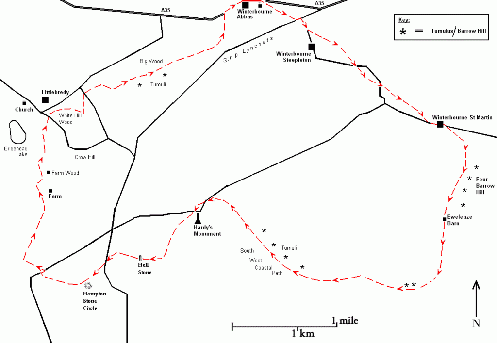
Route: Winterbourne Abbas – Winterbourne St Martin – Hampton Stone Circle – Little Bredy – Winterbourne Abbas
Length: c. 12 miles

The best map is OS Explorer OL15 (1:25,000 scale) otherwise use Landranger 194 (1:50,000).
This walk can be combined with the last part (reversed) of Winterbourne Abbas Walk Two.
From the Little Chef car park in Winterbourne Abbas, walk eastwards for quarter of a mile on the A35. Even before the walk proper begins in this short built-up section there are features to look out for. You will be following the course of a stream, the winterbourne that gives the village its name. Have another look at it. The first thing you will notice about this unremarkable stream is that it is straight. As it runs alongside the A35, a straight road, presumably the course was straightened by Ministry of Transport engineers building the A35 in the nineteen-twenties or whenever. But the houses are in a straight line too and they certainly weren’t built in the nineteen-twenties so it would seem that this particular stream was ‘canalized’ earlier. Judging by the houses, it might have been some grand turnpike scheme of the nineteenth century.
But wait! Winterbourne Abbas. There was a major religious foundation, the Abbey of Cerne, hereabouts and a major religious foundation has certain needs such as year-round water, whereas a winterbourne is only guaranteed to flow for part of the year. Unless it is canalized? The bourne flows right past the church which is on the same alignment as the houses, so what is the relationship between church, winterbourne and abbey? All those monks needed lots of bread so what about a flour mill? They would need a mill race and one sure way of increasing the water’s rate-of-flow is cutting a straight course. What is good for the monastic goose is good for the Roman gander. Or the Iron Age gander. These kinds of questions, especially the extent to which visible changes are superimposed on ancient infrastructures, will occur to you increasingly as you explore the Megalithic landscape.
Carry on past the church and turn right onto the B3159 signposted to Winterbourne Steepleton; a few yards on at a crossroads take the footpath on the left up a short hill. The path is more or less parallel with the road below. The Winterbourne Abbas church with its pronounced tower and Winterbourne Steepleton’s church, one of only two Dorset churches with a steeple, already point to an ancient route but the church’s dedication to St. Michael and All Angels is even more significant because St. Michael is a ‘megalithic saint’. As you head towards Winterbourne Steepleton, look across at the strip lynchets or terraces on the hillside to the right and ask yourself why people cultivated those steep slopes rather than the flat(ter) valley.
The path rejoins the road which you walk along for a short distance until it bends to the right; look for a footpath sign on the left with a stile and follow the path to bypass the road across a succession of fields and stiles to a tarmac lane which leads down into Winterbourne St Martin, or Martinstown. Just before the main road it passes Washing Pool House next to a round stone basin. The basin looks like a well though according to the notice it was for dipping sheep and built in 1590. It is not unusual for sheep to take precedence over people where local resources are concerned. As at Winterbourne Abbas the winterbourne runs straight beside the village street.
Continue along the street past a row of almshouses and a church on the green with a notice board explaining local history. This is not a bad spot to consider how much or how little the English landscape has changed in the last five thousand years. Have sheep always needed dipping? Has there always been a need for almshouses? Notice how close the almshouses are to the green. A village green was a drover’s lay-by where the animals could rest overnight; the inhabitants of the almshouses would have been useful while the drovers themselves rested/drank in the pub. An agricultural society obeys its own logic, past and present, but it is up to you to explain the bits that no longer fit. For instance, remember those strip lynchets? Why do they stand out in a landscape of enclosed fields? It is because strip-farming in very large open fields makes as much sense in 3000 BC as it did in 1000 AD but not in 2000 AD. We know when the strips were amalgamated and enclosed (in the Tudor and Victorian eras) but we have no idea when the Open Field System was introduced. Take no notice of anybody, however eminent, who claims to know.
At the end of the street by a road junction take the path on the right signposted to Friar Waddon. This track is probably a former drovers’ route leading towards the coast which raises another question. Transporting meat is always best done on the hoof, meaning that ancient abattoirs will have been near the coast. So next time you come across a ‘hillfort’ overlooking the sea, don’t immediately assume it is for defence.
The track is occasionally used by vehicles as it leads to Eweleaze Farm where it skirts round the barn and carries straight on. In a field on the right is a hill with a perfectly flat top, shaped like a barrow though not marked as such on the map. At first sight it seems too big to be a man-made structure but if you are aware of the enormous barrows in the area, as on Black Down and Martin’s Down, it forces you to reconsider.
Four Barrow Hill on the left has indeed four mounds visible from the path, in two pairs leading up to the summit as if marking a hierarchy of importance. It is unusual to see a line of barrows so close together even in such a megalithic county as Dorset. Archaeologists have conceded that groups of barrows were expressly aligned to be intervisible. Barrows are often said to be situated on boundaries but a track, then as now, would probably not have crossed land without regard for owners’ rights so whether the track is following the boundary or vice versa is hard to say.
The footpath leads to the (modern) South West Coastal Path which follows the (ancient) ridge path. Facing you is a truly magnificent panorama over Chesil Beach. Immediately to your right you will see two enormous cone-shaped tumuli. An almost uninterrupted series of tumuli and several pits lines the path which you can walk round or over as you wish. But however you proceed try to visualise all this as seen from out-to-sea—that way you can more easily decide who the larger earthworks were actually for.
Many of the smaller pits are filled with nettles which often indicate phosphate, i.e. human and animal remains, in the soil but they are too overgrown now to assess their depth and the functions they served. The OS map, in accordance with general geological opinion, calls them Shake Holes, depressions which form quite naturally in limestone and chalk areas where rock is subjected to water-erosion. It is difficult to tell if these pits are natural or man-made when there is so much evidence of the landscape being sculpted all around. Shake hole-like basins can result from human activity so the pits were just as likely dug simply to reach water trapped underneath the porous chalk. Certainly the holes are quite deep and appear to be connected to the barrow-complex. If they are naturally occurring they seem to naturally occur mostly near megalithic activity. What exactly is natural and what is not in the British landscape is too important a question to leave to archaeologists and geologists.
Barrow beside ridge path
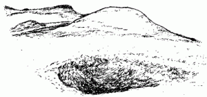
The barrow, which is surrounded by a ditch, is one of a series looking south towards the coast. In front is a pit, which may indicate that the soil used to construct the barrow was taken from here. There are a number of pits beside the path that are marked ‘shake holes’ on the map and assumed to be natural despite the unprecedented number of tumuli lining the ridge path; this is an area that has been unmistakably altered by humans. The barrows continue along the ridge and up the hill on which Hardy’s Monument stands.
Several barrows are surrounded by ditches. One is linked to a straight ditch or passageway lined with stone slabs, whether sarsen or Portland stone is hard to tell. Despite the stony flints littering the path, the going is easy along the ridge and several signposts helpfully indicate place-names as well as distances. Closer to, Hardy’s Monument appears to be on top of a mound or barrow, or more than one (anywhere else one would think it just a hill). By the way, the Monument is to “Kiss me, Hardy” of Nelson’s death-scene fame not the writer, though mention of the latter is a reminder that the famous sheep-leaping-to-their-deaths scene in Far from the Madding Crowd occurred in these very fields.
The path crosses a narrow winding road coming from Martinstown and climbs steeply past Blackdown woods to Smitten Corner where it rejoins the road in front of Hardy’s monument; a row of boulders which appear to be sarsen stones mark the verge at the entrance to the car park. The car park is on the summit of the hill and is noticeably large and level. Apart from the excuse of stopping at the burger van here, there is little to see except for trees stretching almost to the horizon (a look-out platform is open at weekends in the summer). ‘Smitten’ has resonances of smithy-work, occupying a ‘corner’ or meeting point of tracks, the name Black Down suggests this well-used area, pitted with barrows and ‘shake holes’, may have been worked for iron ore, the heathland plants indicating an unusually acid soil in an essentially chalk landscape.
Just south of the car park follow the main track until you reach a path signed ‘West Bexington’ (West Bexington itself is down on Chesil Beach, some nine miles further west) which leads to the Hell Stone, half a mile away. The track is pleasantly shaded, perhaps a remnant of older, more varied woodland in contrast to the modern regimented coniferous plantations.
At a staggered crossroads signposted to Portesham, take the right-hand path which passes through a gate and continues along the left-hand edge of a field. The sign to the Hell Stone is so faded and small as to be barely visible but watch out for the ladder stile that has been provided to climb over the drystone wall on the left.
The Hellstone (looking north)
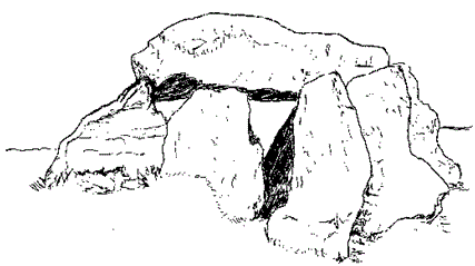
The Hellstone is a sizeable dolmen with a completely rainproof capstone weighing 20 stone. It is next to the path a little to the east of the Hampton stone circle and overlooks Portesham and the coast around Abbotsbury, a good spot for megalithic travellers to top up their provisions. From the ridge most of Chesil Beach is visible as far as the Isle of Portland.
The Hell Stone, restored in the 1860’s, is quite a small dolmen but with enough room between the stones for a grown man to squeeze through and is high enough to stand up inside comfortably. Despite looking somewhat clumsily put together, the entrance, on the eastern side of the chamber, is reportedly aligned true with the mid-winter solstice. Whether the stones were stacked in their original positions has been questioned but, judging by a drawing done prior to the 1866-69 restoration, the present siting is correct.
Carrying on along the path for about ten minutes brings you to the Hampton stone circle, or rather a National Trust sign advising this is the site of an ‘Ancient Monument’. But for the sign you would not notice it because the circle is hard to pick out in the grass and nettles. A clump of stunted trees on the edge of the ridge just south of the circle marks the spot, which would be particularly visible to anyone coming up the hill from the coast. The ground beyond the ridge falls away to a valley overlooking the village of Portesham and a chalk pit that seems to be still in use judging from the bright white glare reflected off the freshly quarried stone.
Hampton Down (looking east)
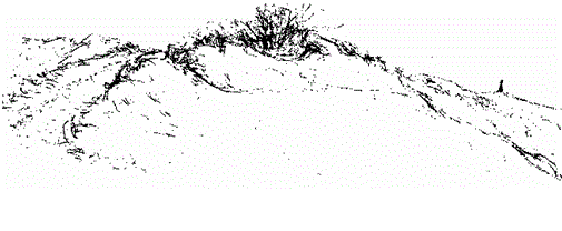
Hampton stone circle is beside the coastal ridge path, on a hill overlooking Chesil Beach and Portland. To its west is St. Catherine’s Hill above Abbotsbury, to its east the Hellstone. Beyond it you can see Hardy’s Monument.
It is time to consider why there are so many stone circles in this area. Since stone circles are re-orientation devices, taking travellers from one direction and putting them onto another, why is so much local re-orientation required here? The reason is ‘Chesil Beach’. Most travellers will be making for known places—immediately Dorchester, and further on Avebury—so that direction is fixed but where they land is not so certain, it could be anywhere along the eighteen miles of Chesil Beach, a perfect landing-place at a time before harbours were feasible engineering projects. So the profusion of stone circles is necessary because people moving inland will need to know the right direction from all points along this eighteen-mile stretch. You of course can check this theory for yourself whenever you encounter some stones by looking at the lie of the land and deciding if you would find the path without them.
Hampton stone circle (looking south from the path)
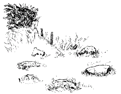
Only a few smallish stones are visible in the tangle of grass and nettles. The circle is on the south side of the coastal ridge path overlooking Chesil Beach. Some or most of the stones were probably carted off for building projects in nearby Portesham. The outstanding feature is a small clump of wind-battered trees on the edge of the hill.
A little further on the path ends at the road leading to Abbotsbury. To the right you can see a parking area or lay-by from where three paths branch off. You need to keep to the one straight ahead of you which goes northwards ignoring the other two on the left. The path leads directly towards a farm, Toppart’s Dairy, at the foot of a large wood marked Farm Wood. The hill next to the farm is called Crow Hill. Since hills in Dorset are not given names as a matter of course, a hill specifically linked to crows is of interest because as it turns out corvids—crows, ravens, rooks, magpies, etc. —are exceptionally clever birds and megalithically significant. For now, notice how crows erupt noisily whenever a stranger walks by, much as a guard dog warns of people approaching, but being so common on farmland their cawing is unremarkable. The nearby wood overlooking Little Bredy is called The Rookery.
Follow the path past Farm Wood and through two gates; still keeping to the edge of the trees carry on northwards and down the hill to Little Bredy. From Little Bredy follow the road and look for White Hill Wood on the right-hand side. Those interested in churches can make a short detour by continuing along the road for a few yards past White Wood and turning left at the T-junction. Little Bredy church is on the left in a dip. The footpath beside the church runs directly to the grounds of Bridehead manor, inescapably recalling Brideshead Revisited. The roadside verge in front of the church is lined with stone blocks, probably sarsen stones.
The existence of another church dedicated to St Michael and All Angels indicates that as at Winterbourne Steepleton it was built on a megalithic site, a landmark on a former drovers’ route connecting Chesil Beach to Dorchester. St. Michael is always an indicator of a Megalithic presence but the inclusion of ‘angels’ also underlines the earlier status of this now negligible church, Angelos meaning messenger in Greek. Hermes was the messenger god, known as Thoth to the Egyptians, Mercury to the Romans and the Archangel Michael in his Christian guise.
A track winds through the wood and comes out past a house beside a metalled road; on the left is the T-junction with the signpost to Winterbourne Abbas, two miles away. The track goes straight across the road and leads to Big Wood. Carry on along the same path as at the start of the walk beside the wood and continue along the edge of the field going north-eastwards towards Winterbourne Abbas. There are no ‘Private’ signs and the roe deer which you may be lucky enough to see no doubt inflict more damage than considerate walkers. Winterbourne Abbas is recognisable from a distance by its square church tower, particularly on days when the St George’s flag is flying. Climb over the gate on the left and go down the side of the field at the bottom of which is the Little Chef, conveniently next to the Coach & Horses.
Leave a Reply