Trade Secrets

Current topics

Re: Trade Secrets

Postby Mick Harper » 12:48 pm

Extract Thirty-One

If this is meant then of course it is an astounding feat of surveying to line up Jethou and Maiden Castle on a single line of longitude over 85 miles, mostly across open ocean, and this is irrespective of which point on the two landmarks is selected. For the record, the actual meridian adopted here runs through the central spine of Jethou and crosses the eastern (the oldest) boundary of Maiden Castle, what modern archaeologists with perhaps unwitting prescience have called the ‘causeway’ of this largest of causewayed enclosures.

But perhaps it would be more realistic to claim that the centre of Jethou and the centre of Maiden Castle are aligned north-south with an accuracy of a few hundred yards in eighty-five miles. But however you judge these things, it is difficult to dispute that this Prime Dorset Meridian passes directly over something that, once given proper recognition, knocks both Jethou and Maiden Castle into the category of Megalithic small beer.
Image
Mick Harper
 
Posts: 911
Joined: 10:28 am

Re: Trade Secrets

Postby macausland » 1:42 pm

I'm not sure what the 'meridian passes over' but the name Jethou reminded me of the old name for Jedburgh in the Scottish borders.

That was Jethart and the locals still call the place 'Jeddart'.

So, I had a look at the longitude of the place and it turns out that it is 2.540 degrees W.

Jethou is 2.4667 degrees W.

And Maiden Castle is 2.4700 degrees W.

Would this be close enough to be significant?

There is a connection with Lindisfarne as well.

'In the year AD854 Ecred, bishop of Lindisfarne, Established two separate settlements on Jed Water, calling them both Gedwearde.'

http://www.jedburgh.org.uk/history
macausland
 
Posts: 339
Joined: 3:17 pm

Re: Trade Secrets

Postby hvered » 2:28 pm

Jedburgh is on Dere Street, a continuation of Ermine Street that runs north from York as far as the Antonine Wall. The section between Jedburgh and Edinburgh was called Via Regia or King's Way so it seems to have been especially important to keep this part of the notoriously bad road in a usable state.
hvered
 
Posts: 855
Joined: 10:22 pm

Re: Trade Secrets

Postby macausland » 4:09 pm

Out of interest would Ermine street be related to 'Hermes' in other comments?
macausland
 
Posts: 339
Joined: 3:17 pm

Re: Trade Secrets

Postby hvered » 4:14 pm

Hermes or 'long stone' (men-hir in Breton) seems an apt description of a long-distance road. There's another Ermine Street which goes east-west from Speen in Berkshire to the Severn and ending at St David's in south-west Wales.

From Witts' Handbook of Gloucestershire:
Most antiquaries are agreed in opinion that this was originally a British Trackway. Its name is thought to be derived from Ερμης (Mercurius), who is said to have presided over the highways.
hvered
 
Posts: 855
Joined: 10:22 pm

Re: Trade Secrets

Postby spiral » 6:58 am

Boreades wrote:
macausland wrote:... which strengthens the idea that their primary purpose was a religious one.

From this distance in time and space, their primary purpose is a matter of guesswork. Locations of strategic importance (as trade hubs) or tactical importance (for navigation) are frequently dual-purpose. The advertised purpose (for the sheeple) is often not the strategic purpose.


That is sort of how I started. Easy navigation of coastal inlets was demonstrated by Jorn, in "The evolution of the Viking Ship", you use (tactics) of "Daymarks". It works round information observed along the shoreline. Crossing the channel is difficult (without a gulp of cormorants aboard) so it makes sense to look at the easiest/earliest route. You go to Calais (you can see the coast opposite) and set sail for Dover. Even if you get blown off course, you will most probably make it over. You then head for Canterbury which is the axis of the harbours. From there you head off down the Pilgrim Way...I reckon you have a good chance of making it.....

One problem, you get to the divert to Winchester, (the old Capital, there is a lot of tin and Amber trade going on. Why?) you reject the current Celtic etymology, you figure out that Win is a variant of Winifred, Queen, Venus etc. So you start Looking round. You pick up the Itchen (Itken) and make your way to the safe waters off the Isle of Wight (Iktus) to discover that most folks have discovered a quicker route by boat....You just don't know how they are crossing.......
spiral
 
Posts: 228
Joined: 8:10 pm

Re: Trade Secrets

Postby hvered » 9:39 am

Islands are still sought and bought by millionaires and recluses, something about exclusivity lingers so it's not only about money but privacy.

Deals have to be hammered out before valuable goods like tin and amber are exchanged, nowadays in an anteroom or office. A tidal island seems to be the business end. In many cases they have no anchorage suitable for large or sometimes any boats but access via a causeway may be provided. The tide is the negotiators' hour-glass.
hvered
 
Posts: 855
Joined: 10:22 pm

Re: Trade Secrets

Postby Mick Harper » 9:56 am

Extract Thirty-Two

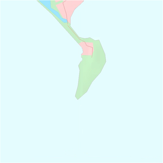
Portland Bill is the closest the British mainland comes to the Channel Islands and it is also due north of the Channel Islands. Is this a coincidence? Yes, but it is a manufactured co-incidence. Of course it is true that because the Channel Islands are to the south of Britain and the South British coastline is roughly east-west, it is likely that the part of the coastline immediately opposite the islands will also be the closest. But strangely enough this is not necessarily the case – in its natural state. Consider the Dorset coast from Lyme Regis to south of Wareham:

Image

It is clear that the ‘natural’ curve of the coast is very much further north, somewhere between Weyouth and Dorchester. In fact it will wash the ramparts of Maiden Castle. What brings the coastline south towards the islands and towards France is Chesil Beach and Portland Island:

Image

Chesil Beach is considered by orthodox geographers both to be a wonder of the world (biggest this, best example of that etc) and just another routine case of what ‘longshore drift’ can do in the right conditions. They seem to be unanimously of the view that in this case, 'the right conditions' came about because of the existence of Portland Island further along the coast. That Chesil Beach was caused by Portland Island. How true!
Mick Harper
 
Posts: 911
Joined: 10:28 am

Re: Trade Secrets

Postby hvered » 10:55 am

macausland wrote:... which strengthens the idea that their primary purpose was a religious one.

An(other) important trade good is animal products: meat, hide, glue. The centre of towns is generally the market place, or village green. Animals transported to the coast need to be enclosed, live ones in a pen. Places where saltworks were producing large amounts of salt may have been best equipped to prepare carcasses.

Wiki says that Thorney Island, at the entrance to Chichester Harbour, got its name from hawthorns, the most secure hedging material, which sounds plausible. The island is cut off from the mainland by a channel but a connecting bridge crosses the salt marshes; despite being a peninsula the name remains. It's now Ministry of Defence property. The only sandy beach is opposite the island at West Wittering. Thorney Island in the Thames is the site of the Palace of Westminster.
hvered
 
Posts: 855
Joined: 10:22 pm

Re: Trade Secrets

Postby macausland » 2:16 pm

'
That is sort of how I started. Easy navigation of coastal inlets was demonstrated by Jorn, in "The evolution of the Viking Ship", you use (tactics) of "Daymarks". It works round information observed along the shoreline. Crossing the channel is difficult (without a gulp of cormorants aboard) so it makes sense to look at the easiest/earliest route. You go to Calais (you can see the coast opposite) and set sail for Dover. Even if you get blown off course, you will most probably make it over. You then head for Canterbury which is the axis of the harbours. From there you head off down the Pilgrim Way...I reckon you have a good chance of making it.....'

Were people making journeys to France before Doggerland disappeared?

If so did they go overland or follow a much more southerly coastline?

Did they have to redefine their navigation techniques when the Channel opened up?
macausland
 
Posts: 339
Joined: 3:17 pm

PreviousNext

Return to Index

Who is online

Users browsing this forum: Bing [Bot] and 346 guests