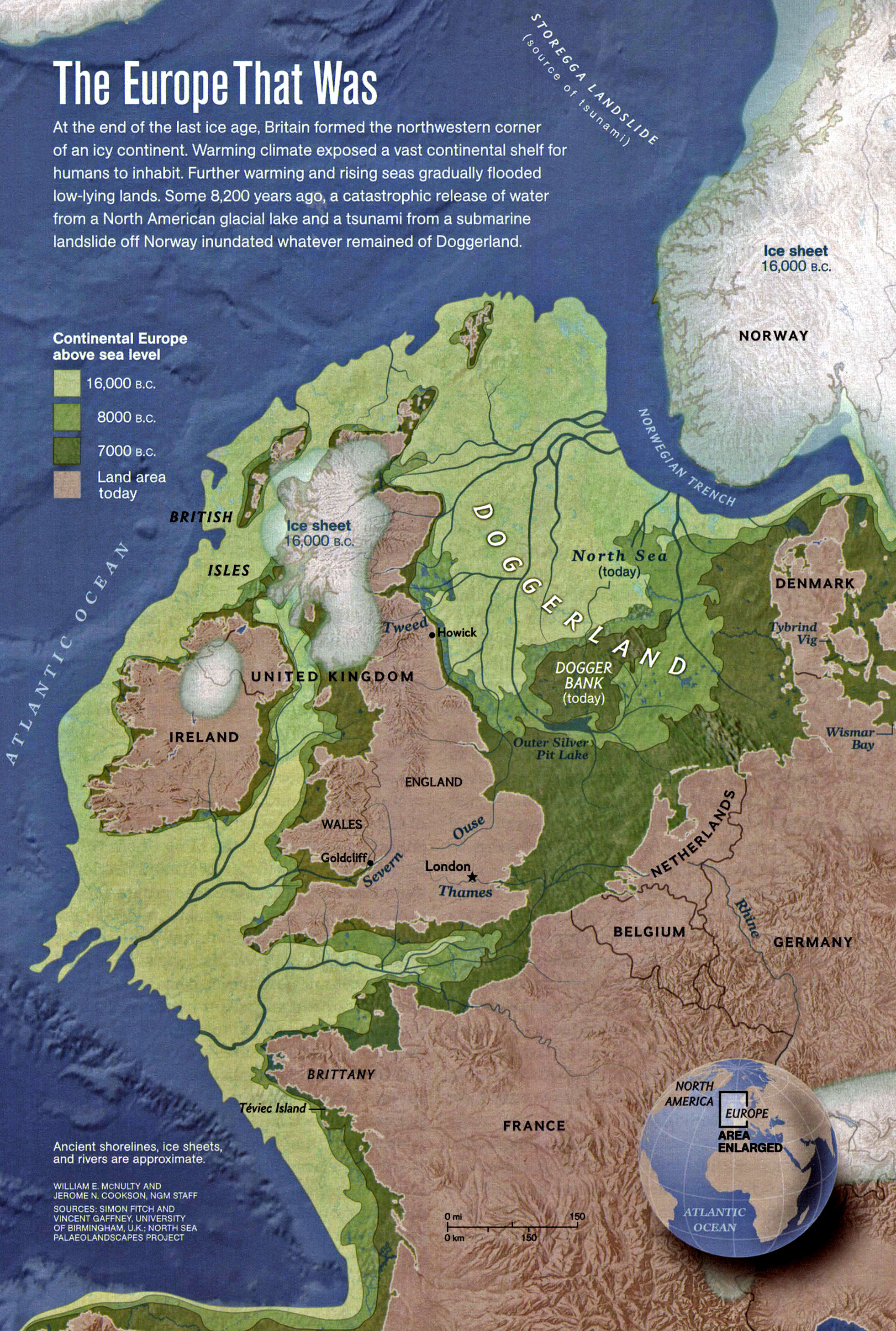
'Map of the shoreline in the neighbourhood of the British Isles, ca 18 000 BP.
Note that the ice sheet shown on Britain in this map is much smaller for the same date than most other maps.
Photo: National Geographic Vol. 222 No 6 December 2012 '
This is a map showing the extent to which Britain was joined to Europe and how far the land extended westwards and northwards as well as showing the size of Doggerland eighteen thousand years ago.
It shows quite clearly how the resettlers in the west were isolated from those further east.
http://www.donsmaps.com/icemaps.htmlThe return of people to Britain was apparently much quicker than had previously been thought.
'"The big question has always been how quickly, and in what number, did people return once the glaciers had retreated," said research team leader Nick Barton, from the anthropology department of Oxford Brookes University, Oxford, England. "Now with the benefit of larger numbers of radiocarbon dates corrected against a highly accurate record of global climatic change from the Greenland ice record, it seems reoccupation was an almost instantaneous event across northern and central Europe." '
http://news.nationalgeographic.com/news ... tion2.html


