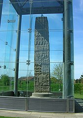
Based on no evidence at all, I'll hypothesis that after the "Irish" megalithics had finished Newgrange they came over here to start a Wiltshire version.
Newgrange was constructed over 5,000 years ago (about 3,200 B.C.) during the Neolithic period, which makes it older than Stonehenge and Great Pyramids of Giza.
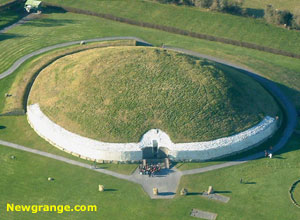
http://www.newgrange.com/
They got as far as the arc of stones we've just found. And then stopped, or abandoned the project.
Why?
The modern Ordnance Survey maps are actually a hindrance to any understanding, as they have too much modern detail and have lost a lot of the subtleties of older versions.
Fortunately there is a very good archive of historic OS maps here:
http://www.sabre-roads.org.uk/maps/
Choose (for example) the 1:25,000 series and zoom in on Amesbury. Next to the Abbey it just says "Camp" - that's "Vespasian's Camp". Of course it's called a hillfort even though (as usual) there's bugger all evidence of it being a fort. But as a dock or port on the river it makes a lot more sense, especially with its proximity to The Avenue that curves up to Stonehenge.