Megalithic shipping and trade routes

Current topics

Re: Megalithic shipping and trade routes

Postby hvered » 8:26 pm

Boreades wrote: Would you like to go sailing there again?
The SS Golden Rivet is now seaworthy.

I'm just a dilettante sailor, sounds fun though.
hvered
 
Posts: 856
Joined: 10:22 pm

Re: Megalithic shipping and trade routes

Postby hvered » 7:16 am

A hill in Wiltshire on telly caught my eye whilst being transported into the slightly strange world of a public school.

This is about the closest to the view (minus dog), taken from Battlesbury Camp looking towards Cley Hill

Image

Warminster as its name suggests is quite a military sort of place and the school's head used to be in the army.

This is the sort of 'explanation' for Cley Hill that gets printed... "2000 years before, an important local leader chose the hill top as his monument. His burial mound has dominated the skyline ever since. It was too prominent to be ignored."
hvered
 
Posts: 856
Joined: 10:22 pm

Re: Megalithic shipping and trade routes

Postby hvered » 7:42 am

Just located Cley Hill on Google Earth and found that a line between Stonehenge and Lundy Island (which I'd drawn to 'test' a 3:4:5 triangle claim elsewhere) passes immediately south of Warminster and Cley Hill.

The line crosses straight through the middle of Longleat, famous for its safari park. Longleat is connected with Christopher Wren who modified parts of the house and, incidentally, one of Warminster School's doors as the headmaster was proud to point out.
hvered
 
Posts: 856
Joined: 10:22 pm

Re: Megalithic shipping and trade routes

Postby hvered » 7:32 am

Along with brochs, another speciality peculiar to Scotland and Ireland are crannogs which seem to have been part of almost all the major lochs. They are according to Wiki

"... typically a partially or entirely artificial island, usually built in lakes, rivers and estuarine waters of Scotland and Ireland. Unlike the prehistoric pile dwellings around the Alps that were built on the shores and were inundated only later on, crannogs were built in the water, thus forming artificial islands."

What is most striking is that crannogs were maintained for so long, some still being in use in the seventeenth century, so the usual explanations -- such as 'homesteads', 'fishing stations', 'refuges in times of trouble', even 'status symbol'-- may have had some relevance at certain times but seem over-blown for what are after all fairly basic structures.

Wiki article shows a crannog on Loch Tay, a familiar-looking reconstruction

Image

I've seen similar structures on the Thames. I don't know what they're called....boat-houses perhaps. Anyway I wondered if the circular shelter on the crannog would fit a coracle or if it simply arose out of some archaeologist's Iron Age round-house construction kit.
hvered
 
Posts: 856
Joined: 10:22 pm

Re: Megalithic shipping and trade routes

Postby hvered » 3:32 pm

A bit more on Warminster... just had a heads up from David Clarke who writes about UFOlogy that Warminster is a centre of flying saucer/UFO watchers and it's the anniversary of 'The Warminster Thing'.

The 'Thing' which made horrible droning noises and terrorised a flock of pigeons was supposed to be from outer space. The Chairman of the British UFO Research Association reassured the inhabitants and, says Clarke, "He went on to link UFOs with fashionable New Age ideas about ley lines and suggested aliens could be using an ancient earthwork nearby as a ‘homing beacon’."

Clarke adds "one of the key skywatch locations, Cradle Hill, sat alongside the largest military training zone in the UK. Large areas of Salisbury Plain are used by the British Army for weapons testing and many square miles are closed to the public even today."

It should have been a lot of fuss about nothing but respected locals kept the story going. It seems businesses in Warminster did extremely well out of the media coverage and the town remains a pilgrimage centre.
hvered
 
Posts: 856
Joined: 10:22 pm

Re: Megalithic shipping and trade routes

Postby Mick Harper » 3:35 pm

In my childhood, we used to sit around the table reading about The Warminster Thing in Flying Saucer Review to which my father subscribed.
Mick Harper
 
Posts: 929
Joined: 10:28 am

Re: Megalithic shipping and trade routes

Postby TisILeclerc » 12:31 pm

Here's a job opportunity for Cap'n Borry of the SS Golden Rivet.

The archeonauts are launching an underwater investigation to find our lost tribes. They assume they are British tribes. I'm not sure whether there will be any left but they do hope to discover fragments.

Perhaps they will need the services of the Golden Rivet and an expert guide in their endeavours.

'Archaeologists are searching for the lost tribes of prehistoric Britain – at the bottom of the North Sea.

In a unique and ground-breaking operation, scientists plan to search for evidence of Stone Age human activity on Britain’s very own ‘Atlantis’ – a vast prehistoric land, once located between England and southern Scandinavia, which was engulfed by rising sea levels some 7500 years ago.

The archaeologists hope to find evidence of flint tool manufacture, plant pollen and the DNA of plant and animal species used by the long-lost land’s ancient inhabitants. Due to be launched later this month, the multi-million pound project is the largest of its kind ever attempted anywhere in the world and will lead to the development by British scientists of an entire range of new scientific techniques and capabilities.'


http://www.independent.co.uk/news/scien ... 80279.html

You could make a fortune Borry.

As usual the Daily Mail gives more information and prettier pictures on this subject.

http://www.dailymail.co.uk/news/article ... s-ago.html
TisILeclerc
 
Posts: 790
Joined: 11:40 am

Re: Megalithic shipping and trade routes

Postby Boreades » 11:18 pm

hvered wrote:The 'Thing' which made horrible droning noises .


I have it from an authoritative source that worked at Boscombe Down in the late 60's and 70's that the horrible droning things were a first generation of UK remote-control drone aircraft.

These days, we are accustomed to seeing TV coverage of remote-controlled drones with GPS and precision digital accuracy. Back then, before GPS, it was all analogue, and the remote-control was unreliable and inaccurate. So those early drones wobbled a lot and often changed direction. The thing was, being semi-secret devices, the test flight paths went over the least populated areas. From Boscombe, that meant flying west, over Salisbury Plain and the Somerset Levels. Which meant these things flew over places like Avebury, Warminster and Glastonbury. Places fairly well stocked with stoned hippies who noticed strange flashing lights wobbling in the skies.

Being secret, the MoD denied they existed. Oh wow man, it must be UFOs. One particularly unfortunate individual was Reg Presley (of The Troggs). His home in Somerset was under one of these test flight paths. Unfortunate because he became convinced they were genuine UFOs and then spent a large part of what he had earned from The Troggs on UFO research for the next 40 years.
Boreades
 
Posts: 2113
Joined: 2:35 pm

Re: Megalithic shipping and trade routes

Postby Boreades » 11:22 pm

TisILeclerc wrote:Here's a job opportunity for Cap'n Borry of the SS Golden Rivet...You could make a fortune Borry.


I wish. Sadly the SS Golden Rivet is in need of repairs and will be in dry dock for some time. The TME Team Cruise will have to be delayed for the moment.
Boreades
 
Posts: 2113
Joined: 2:35 pm

Re: Megalithic shipping and trade routes

Postby hvered » 11:45 pm

There's a region, historically part of Prussia, called Warmia, or Varmia. It used to be called Ermeland [Ermland].

ERMELAND, or ERN - Land (Varmia), a district of Germany, in East Prussia, extending from the Frisches Haff, a bay in the Baltic, inland towards the Polish frontier. It is a well-wooded sandy tract of country, has an area of about 1650 sq. m., a population of 240,000, and is divided into the districts of Braunsberg, Heilsberg, Russel and Allenstein.


The Teutonic Knights were, if Wiki is correct, 'invited to Christianise the pagan Prussians' but seem to have been mainly occupied with securing/maintaining the borders.
Ermeland was originally one of the eleven districts of old Prussia and was occupied by the Teutonic Knights (Deutscher Orden), being made in 1250 one of the four bishoprics of the country under their sway. The bishop of Ermeland shortly afterwards declared himself independent of the order, and became a prince of the Empire.


One of Ermeland's inhabitants was Copernicus who lived in Frombork, now in northern Poland, on the Vistula Lagoon. Frombork cathedral is a landmark both to the town's most famous resident and in its own right: "In the northwest corner of the cathedral grounds is Copernicus' tower, and in the southwest corner an octagonal building with a square bell tower and a small planetarium and a Foucault's pendulum. From atop the tower one can survey the town, the tiny harbor, the great panorama of the Baltic Sea, and much of Warmia's countryside."

Image

There was also a Warmian pope...a Sylvius no less.
Among the bishops of the see, which still exists, with its seat in Frauenberg, may be mentioned Aeneas Sylvius Piccolomini, afterwards Pope Pius II., and Cardinal Stanislaus Hosius (1504-1579), the founder of the Jesuit college in Braunsberg.
[Frauenberg translates as 'Our Lady's Fortress', cf. Marienburg]

The Wiki article on Warmia mentions prehistoric settlements and artificial islands
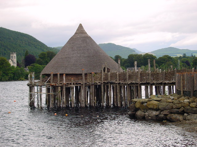
The first traces of human settlement in the region come from roughly 14 to 15 thousand years ago: traces of settlements made by the Lusatian culture (thirteenth—fifth century BC), including above-ground water housings and artificial islands.
hvered
 
Posts: 856
Joined: 10:22 pm

PreviousNext

Return to Index

Who is online

Users browsing this forum: No registered users and 1 guest